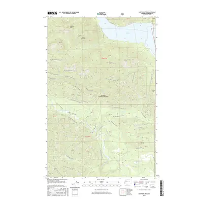
2017 Map of Lightning Peak
USGS Topo · Published 2017About this map
Lightning Peak and the high ridges of the Olympic Mountains define this landscape within the Olympic National Forest. The map documents a complex network of forest development roads, such as Natl Forest Develop Road 23 Rd, which provide access to the timbered slopes and creek drainages. The shoreline of Lake Cushman occupies the northeastern corner, while the South Fork Skokomish River cuts through the southern terrain, fed by numerous tributaries including Brown Cr, Elk Cr, and Rock Cr. This 2017 survey illustrates the managed forest landscape and protected wilderness typical of western Mason County. The topography is marked by significant elevations like Timber Mtn and Dry Mtn, alongside localized landmarks such as Dennie Ahl Hill and Prospect Ridge.
Find a feature on this map
63 named features on this map. Tap any name to fly to it.
Don’t see what you’re looking for? This feature index may not catch every label — zoom into the map to look around manually.
Map Details
Editions of this 2017 Lightning Peak Map
This is the sole edition of this map. No revisions or reprints were ever made.
Other maps of this area

1938 · Mt Constance
USGS Topo · 1:125,000

1943 · Potlatch
USGS Topo · 1:62,500

1947 · The Brothers
USGS Topo · 1:62,500

1947 · Mt. Steel
USGS Topo · 1:62,500

1950 · The Brothers
USGS Topo · 1:62,500

1950 · Mt. Steel
USGS Topo · 1:62,500

1952 · Potlatch
USGS Topo · 1:62,500

1953 · Mt Tebo
USGS Topo · 1:62,500

1958 · Seattle
USGS Topo · 1:250,000

1962 · Seattle
USGS Topo · 1:250,000