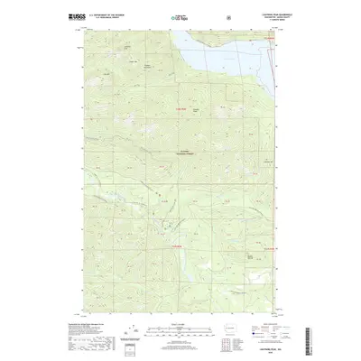
2020 Map of Lightning Peak
USGS Topo · Published 2020About this map
Olympic National Forest dominates this section of the Olympic Mountains, where steep ridges and deep drainage basins define the landscape of Mason County. Significant elevations including Lightning Peak, Timber Mtn, and Dry Mtn overlook the northern reaches of Lake Cushman. The network of waterways is extensive, with the South Fork Skokomish River carving through the southern half of the quadrangle, joined by tributaries such as Brown Cr, Gibbons Cr, and McTaggert Cr.
Find a feature on this map
50 named features on this map. Tap any name to fly to it.
Don’t see what you’re looking for? This feature index may not catch every label — zoom into the map to look around manually.
Map Details
Editions of this 2020 Lightning Peak Map
This is the sole edition of this map. No revisions or reprints were ever made.
Other maps of this area

1938 · Mt Constance
USGS Topo · 1:125,000

1943 · Potlatch
USGS Topo · 1:62,500

1947 · The Brothers
USGS Topo · 1:62,500

1947 · Mt. Steel
USGS Topo · 1:62,500

1950 · The Brothers
USGS Topo · 1:62,500

1950 · Mt. Steel
USGS Topo · 1:62,500

1952 · Potlatch
USGS Topo · 1:62,500

1953 · Mt Tebo
USGS Topo · 1:62,500

1958 · Seattle
USGS Topo · 1:250,000

1962 · Seattle
USGS Topo · 1:250,000