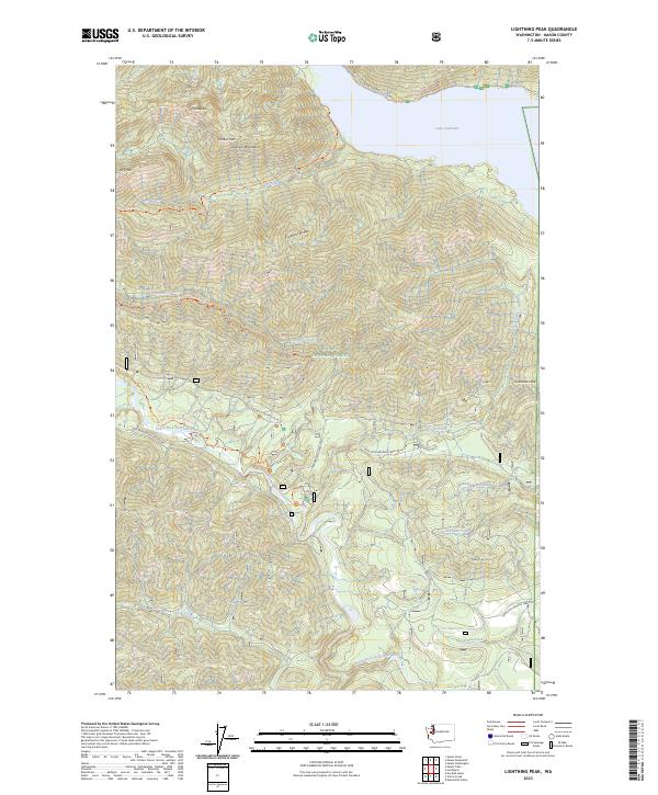
2023 Map of Lightning Peak
USGS Topo · Published 2023About this map
Lightning Peak and the high elevations of the Olympic Mountains define this landscape within the Olympic National Forest. The map detail follows the varied topography of Prospect Ridge and Timber Mtn as they descend toward the significant waters of Lake Cushman in the northeast. This area is characterized by a network of drainage systems including Le Bar Creek, Dry Creek, and the prominent South Fork Skokomish River which meanders through the southern half of the quadrangle.
Find a feature on this map
49 named features on this map. Tap any name to fly to it.
Don’t see what you’re looking for? This feature index may not catch every label — zoom into the map to look around manually.
Map Details
Editions of this 2023 Lightning Peak Map
This is the sole edition of this map. No revisions or reprints were ever made.
Other maps of this area

1938 · Mt Constance
USGS Topo · 1:125,000

1943 · Potlatch
USGS Topo · 1:62,500

1947 · The Brothers
USGS Topo · 1:62,500

1947 · Mt. Steel
USGS Topo · 1:62,500

1950 · The Brothers
USGS Topo · 1:62,500

1950 · Mt. Steel
USGS Topo · 1:62,500

1952 · Potlatch
USGS Topo · 1:62,500

1953 · Mt Tebo
USGS Topo · 1:62,500

1958 · Seattle
USGS Topo · 1:250,000

1962 · Seattle
USGS Topo · 1:250,000