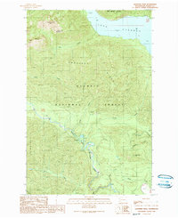
1990 Map of Lightning Peak
USGS Topo · Published 1990About this map
Lake Cushman and the high elevations of the Olympic Peninsula dominate this 1990 survey, showing the transition between protected wilderness and working forest land. The rugged geography is defined by Prospect Ridge and peaks such as Lightning Peak and Timber Mountain. To the north, the boundary of the Mount Skokomish Wilderness meets the broader Olympic National Forest, providing a clear view of the land management and conservation boundaries of the late twentieth century. Along the valley floor, the South Fork Skokomish River winds through the landscape, supported by numerous tributaries including Le Bar Creek and Brown Creek. Recreation and resource use are evident through the presence of the Brown Creek Campground and localized industrial features like the Borrow Pit near the river. The map also traces various creeks such as McTaggert Creek and Gibbons Creek, which feed into the larger river system.
Find a feature on this map
24 named features on this map. Tap any name to fly to it.
Don’t see what you’re looking for? This feature index may not catch every label — zoom into the map to look around manually.
Map Details
Editions of this 1990 Lightning Peak Map
This is the sole edition of this map. No revisions or reprints were ever made.
Other maps of this area

1938 · Mt Constance
USGS Topo · 1:125,000

1943 · Potlatch
USGS Topo · 1:62,500

1947 · The Brothers
USGS Topo · 1:62,500

1947 · Mt. Steel
USGS Topo · 1:62,500

1950 · The Brothers
USGS Topo · 1:62,500

1950 · Mt. Steel
USGS Topo · 1:62,500

1952 · Potlatch
USGS Topo · 1:62,500

1953 · Mt Tebo
USGS Topo · 1:62,500

1958 · Seattle
USGS Topo · 1:250,000

1962 · Seattle
USGS Topo · 1:250,000