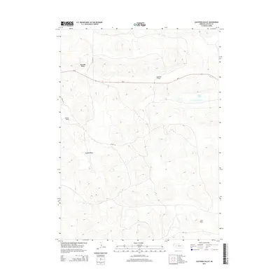
2014 Map of Lightning Valley
USGS Topo · Published 2014About this map
Lightning Valley anchors this corner of the Nebraska Sandhills, where the undulating terrain is punctuated by small depressions and ephemeral water bodies like Duck Lake. In 2014, the landscape remains characterized by ranching operations and isolated homesteads, specifically identified as Rounds Place and Lyons Place. These named sites reflect the lineage of local families in Arthur County, where the topography of Helmer Valley and Loyd Valley dictates the path of travel. The primary east-west artery, Ne-92, cuts through the valley floor, while a sparse network of unpaved tracks such as Triangle Rd and Enfield Rd provide access to the surrounding hills. This survey illustrates the persistent reliance on natural valleys for both transportation and settlement in a region where water sources and topographic shelter are primary concerns for land management.
Find a feature on this map
10 named features on this map. Tap any name to fly to it.
Don’t see what you’re looking for? This feature index may not catch every label — zoom into the map to look around manually.
Map Details
Editions of this 2014 Lightning Valley Map
This is the sole edition of this map. No revisions or reprints were ever made.
Other maps of this area

1897 · Ogallala
USGS Topo · 1:125,000

1898 · Paxton
USGS Topo · 1:125,000

1900 · Ogallala
USGS Topo · 1:125,000

1901 · Paxton
USGS Topo · 1:125,000

1949 · Arthur
USGS Topo · 1:62,500

1949 · Flats
USGS Topo · 1:62,500

1950 · Flats
USGS Topo · 1:62,500

1950 · Arthur
USGS Topo · 1:62,500

1954 · North Platte
USGS Topo · 1:250,000

1956 · North Platte
USGS Topo · 1:250,000