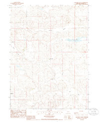
1985 Map of Lightning Valley
USGS Topo · Published 1986About this map
Lightning Valley and the surrounding sandhills of Arthur County characterize this mid-1980s landscape, where cattle ranching defines the geography of the Nebraska panhandle. The map reveals a pattern of isolated homesteads situated within natural depressions and valleys, including the Helmer Ranch and Enfield Ranch in the west, and the Bar 91 Ranch toward the center. This period in the region's history shows a sparse but established network of private operations, with land use largely dictated by the undulating terrain of the Loyd Valley and Helmer Valley. Human modification of the arid environment is visible through features like the Ditch near the Enfield property and the presence of Duck Lake, which provided essential water for livestock in a landscape primarily navigated by unpaved trails.
Find a feature on this map
13 named features on this map. Tap any name to fly to it.
Don’t see what you’re looking for? This feature index may not catch every label — zoom into the map to look around manually.
Map Details
Editions of this 1985 Lightning Valley Map
This is the sole edition of this map. No revisions or reprints were ever made.
Other maps of this area

1897 · Ogallala
USGS Topo · 1:125,000

1898 · Paxton
USGS Topo · 1:125,000

1900 · Ogallala
USGS Topo · 1:125,000

1901 · Paxton
USGS Topo · 1:125,000

1949 · Arthur
USGS Topo · 1:62,500

1949 · Flats
USGS Topo · 1:62,500

1950 · Flats
USGS Topo · 1:62,500

1950 · Arthur
USGS Topo · 1:62,500

1954 · North Platte
USGS Topo · 1:250,000

1956 · North Platte
USGS Topo · 1:250,000