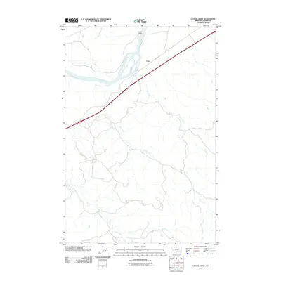
2011 Map of Lignite Creek
USGS Topo · Published 2011About this map
The Yellowstone River cuts across the northern landscape near the small community of Ulmer, where modern transportation corridors parallel the ancient watercourse. This 2011 survey illustrates the confluence of several key drainages in the Custer County ranchlands, including the winding paths of Lignite Creek, Coal Creek, and Reservation Creek. The Paragon Bridge serves as a critical crossing point over the river, linking the rural roads to the interstate highway system that now dominates the local transit pattern.
Find a feature on this map
9 named features on this map. Tap any name to fly to it.
Don’t see what you’re looking for? This feature index may not catch every label — zoom into the map to look around manually.
Map Details
Editions of this 2011 Lignite Creek Map
This is the sole edition of this map. No revisions or reprints were ever made.
Other maps of this area

1953 · Miles City
USGS Topo · 1:250,000

1954 · Forsyth
USGS Topo · 1:250,000

1957 · Miles City
USGS Topo · 1:250,000

1957 · Forsyth
USGS Topo · 1:250,000

1958 · Miles City
USGS Topo · 1:250,000

1958 · Forsyth
USGS Topo · 1:250,000

1968 · Big Hill
USGS Topo · 1:24,000

1968 · Miles City
USGS Topo · 1:24,000

1968 · Lignite Creek
USGS Topo · 1:24,000

1968 · Butterfly Creek
USGS Topo · 1:24,000