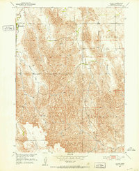
1951 Map of Lillian
USGS Topo · Published 1952About this map
Victoria Springs State Park anchors the northwestern corner of this Custer County landscape, established near the settlement of New Helena. The map reveals a mid-century rural infrastructure defined by scattered windmills and small country schools like Parritor Sch and Pleasant Valley Sch, which served the farming families of Pleasant Valley and the Lillian Valley.
Find a feature on this map
20 named features on this map. Tap any name to fly to it.
Don’t see what you’re looking for? This feature index may not catch every label — zoom into the map to look around manually.
Map Details
Editions of this 1951 Lillian Map
3 editions found
Other maps of this area

1951 · Broken Bow NE
USGS Topo · 1:24,000

1951 · Lillian
USGS Topo · 1:24,000

1951 · Anselmo
USGS Topo · 1:24,000

1951 · Broken Bow
USGS Topo · 1:24,000

1951 · Merna
USGS Topo · 1:24,000

1951 · Walworth
USGS Topo · 1:24,000

1951 · Anselmo NE
USGS Topo · 1:24,000

1951 · Round Valley
USGS Topo · 1:24,000

1951 · Milburn
USGS Topo · 1:24,000

1955 · Broken Bow
USGS Topo · 1:250,000