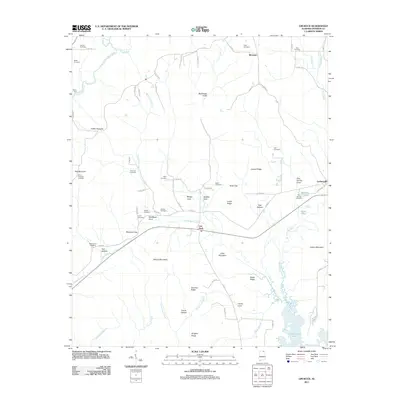
2011 Map of Lim Rock
USGS Topo · Published 2011About this map
Lim Rock and Larkinsville serve as central points in this Jackson County landscape, where the terrain is defined by a series of prominent ridges and coves. The southern portion of the quadrangle is dominated by the waters of Guntersville Lake, which reach into the interior via Blue Spring Creek and Yellow Branch. High ground like McCoy Mountain and Nat Mountain separates the valley floors, creating distinct geographic pockets such as Schiffman Cove and Caney Cove.
Find a feature on this map
81 named features on this map. Tap any name to fly to it.
Don’t see what you’re looking for? This feature index may not catch every label — zoom into the map to look around manually.
Map Details
Editions of this 2011 Lim Rock Map
This is the sole edition of this map. No revisions or reprints were ever made.
Other maps of this area

1888 · Scottsboro
USGS Topo · 1:125,000

1892 · Scottsboro
USGS Topo · 1:125,000

1936 · Scottsboro
USGS Topo · 1:24,000

1936 · Langston
USGS Topo · 1:24,000

1936 · Hollytree
USGS Topo · 1:24,000

1936 · Mud Creek
USGS Topo · 1:24,000

1936 · Grant
USGS Topo · 1:24,000

1936 · Princeton
USGS Topo · 1:24,000

1936 · Lim Rock
USGS Topo · 1:24,000
1936 · Swearengin
USGS Topo · 1:24,000