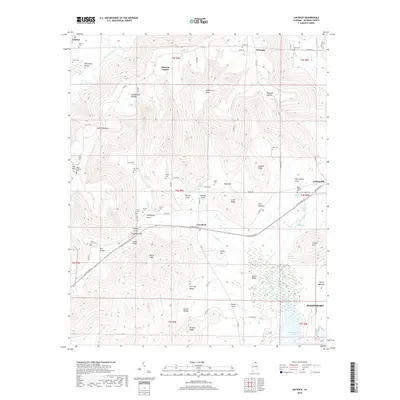
2018 Map of Lim Rock
USGS Topo · Published 2018About this map
Lim Rock serves as a central hub in this Jackson County landscape, situated where the southern slopes of the Cumberland Plateau meet the lowlands of the North Sauty Creek basin. The area is defined by complex topography, from the deep McAllister Sinks and Coffey Narrows in the north to the broad wetlands of Sauty Bottoms and Guntersville Lake in the southeast. This survey reveals a high density of rural burial grounds and family-named landmarks, such as Harrison Cem, Dotson Cem, and Berry Cem, which offer significant value for genealogical research. The transition from the highland coves like Schiffman Cove and Stephens Gap to the valley floor illustrates the historic settlement patterns along the Paint Rock River and its tributaries. To the east, the map captures the edge of Scottsboro, marking the intersection of rugged ridge-and-valley terrain with modern infrastructure like the J5 Mike Airport.
Find a feature on this map
94 named features on this map. Tap any name to fly to it.
Don’t see what you’re looking for? This feature index may not catch every label — zoom into the map to look around manually.
Map Details
Editions of this 2018 Lim Rock Map
This is the sole edition of this map. No revisions or reprints were ever made.
Other maps of this area

1888 · Scottsboro
USGS Topo · 1:125,000

1892 · Scottsboro
USGS Topo · 1:125,000

1936 · Scottsboro
USGS Topo · 1:24,000

1936 · Langston
USGS Topo · 1:24,000

1936 · Hollytree
USGS Topo · 1:24,000

1936 · Mud Creek
USGS Topo · 1:24,000

1936 · Grant
USGS Topo · 1:24,000

1936 · Princeton
USGS Topo · 1:24,000

1936 · Lim Rock
USGS Topo · 1:24,000
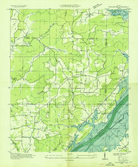
1936 · Swearengin
USGS Topo · 1:24,000