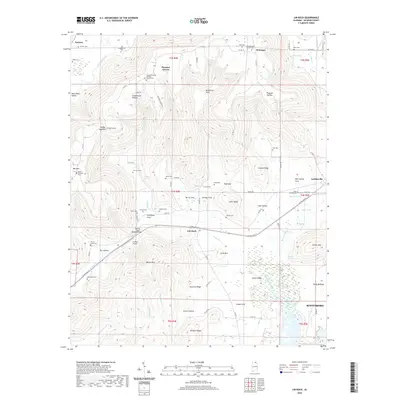
2020 Map of Lim Rock
USGS Topo · Published 2020About this map
The Cumberland Plateau dominates the northern reaches of this Jackson County landscape, where deep hollows like Pinhook Hollow and Farr Hollow break away from the high ground. Small rural settlements and family burial grounds are scattered throughout the terrain, including Trenton, Wininger, and Pleasant Groves. The map reveals a high concentration of cemeteries such as the Old Kirkpatrick Cem and Harrison Cem, which serve as vital markers for local genealogical research and family history in this corner of Alabama.
Find a feature on this map
86 named features on this map. Tap any name to fly to it.
Don’t see what you’re looking for? This feature index may not catch every label — zoom into the map to look around manually.
Map Details
Editions of this 2020 Lim Rock Map
This is the sole edition of this map. No revisions or reprints were ever made.
Other maps of this area

1888 · Scottsboro
USGS Topo · 1:125,000

1892 · Scottsboro
USGS Topo · 1:125,000

1936 · Scottsboro
USGS Topo · 1:24,000

1936 · Langston
USGS Topo · 1:24,000

1936 · Hollytree
USGS Topo · 1:24,000

1936 · Mud Creek
USGS Topo · 1:24,000

1936 · Grant
USGS Topo · 1:24,000

1936 · Princeton
USGS Topo · 1:24,000

1936 · Lim Rock
USGS Topo · 1:24,000
1936 · Swearengin
USGS Topo · 1:24,000