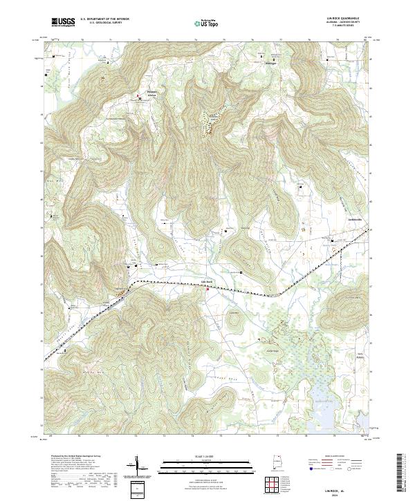
2024 Map of Lim Rock
USGS Topo · Published 2024About this map
Paint Rock River winds through the northwestern corner of this Jackson County landscape, carving the Paint Rock Valley beneath the rising slopes of the Cumberland Plateau. The area's complex topography is defined by numerous coves and hollows, such as Berrys Cove and Gentles Cove, which are pockets of flatter ground amidst the ridges. Small settlements like Lim Rock and Larkinsville are situated along the southern transportation corridor, while Pleasant Groves sits atop the higher elevations to the north.
Find a feature on this map
101 named features on this map. Tap any name to fly to it.
Don’t see what you’re looking for? This feature index may not catch every label — zoom into the map to look around manually.
Map Details
Editions of this 2024 Lim Rock Map
This is the sole edition of this map. No revisions or reprints were ever made.
Other maps of this area

1888 · Scottsboro
USGS Topo · 1:125,000

1892 · Scottsboro
USGS Topo · 1:125,000

1936 · Scottsboro
USGS Topo · 1:24,000

1936 · Langston
USGS Topo · 1:24,000

1936 · Hollytree
USGS Topo · 1:24,000

1936 · Mud Creek
USGS Topo · 1:24,000

1936 · Grant
USGS Topo · 1:24,000

1936 · Princeton
USGS Topo · 1:24,000

1936 · Lim Rock
USGS Topo · 1:24,000
1936 · Swearengin
USGS Topo · 1:24,000