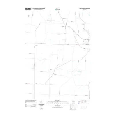
2013 Map of Lima Center
USGS Topo · Published 2013About this map
Lima Center serves as the focal point of this rural Wisconsin landscape, situated along the diagonal path of WI-59. The surrounding terrain is characterized by a dense network of country roads and family agriculture, including the Pond Hill Dairy Farm and Lauer Willis Farm. This 2013 survey illustrates the complex drainage of the area, where several waterways like Spring Brook, Otter Cr, and Galloway Cr move through the farmland toward Whitewater Creek. Near the eastern edge, the landscape transitions toward more modern infrastructure and specialized sites, such as the Onyx Valley Metal Landfill and Gutzmer's Twin Oaks Airport. The road network is particularly dense here, featuring the intersection of Us-12 and US-12 Bus, which helps define the local transit patterns connecting smaller crossroads like Utters Corners to the larger regional thoroughfares.
Find a feature on this map
59 named features on this map. Tap any name to fly to it.
Don’t see what you’re looking for? This feature index may not catch every label — zoom into the map to look around manually.
Map Details
Editions of this 2013 Lima Center Map
This is the sole edition of this map. No revisions or reprints were ever made.
Other maps of this area

1891 · Koshkonong
USGS Topo · 1:62,500

1892 · Whitewater
USGS Topo · 1:62,500

1893 · Delavan
USGS Topo · 1:62,500

1893 · Whitewater
USGS Topo · 1:62,500

1893 · Shopiere
USGS Topo · 1:62,500

1894 · Koshkonong
USGS Topo · 1:62,500

1903 · Whitewater
USGS Topo · 1:62,500

1906 · Koshkonong
USGS Topo · 1:62,500

1924 · Whitewater
USGS Topo · 1:62,500

1954 · Rockford
USGS Topo · 1:250,000