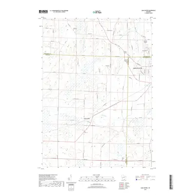
2018 Map of Lima Center
USGS Topo · Published 2018About this map
Lima Center and the western outskirts of Whitewater anchor this 2018 survey of the fertile agricultural borderlands where Jefferson, Rock, and Walworth counties meet. The landscape is defined by the gentle drainage of Otter Creek and Spring Brook, which weave through a grid of rural roads named for early families, such as McIntyre Road and Trewyn Road. For genealogists and local historians, the map preserves the location of Koshkonong Union Cemetery and the Lima Center Cemetery, providing a precise look at the burial grounds and rural hubs like Utters Corners in the southern portion of the quadrangle. In the northeast, Gutzmer's Twin Oaks Airport represents a modern aviation landmark amidst the traditional dairy-country road network, while the expansion of Whitewater is evident along Indian Mound Parkway.
Find a feature on this map
65 named features on this map. Tap any name to fly to it.
Don’t see what you’re looking for? This feature index may not catch every label — zoom into the map to look around manually.
Map Details
Editions of this 2018 Lima Center Map
This is the sole edition of this map. No revisions or reprints were ever made.
Other maps of this area

1891 · Koshkonong
USGS Topo · 1:62,500

1892 · Whitewater
USGS Topo · 1:62,500

1893 · Delavan
USGS Topo · 1:62,500

1893 · Whitewater
USGS Topo · 1:62,500

1893 · Shopiere
USGS Topo · 1:62,500

1894 · Koshkonong
USGS Topo · 1:62,500

1903 · Whitewater
USGS Topo · 1:62,500

1906 · Koshkonong
USGS Topo · 1:62,500

1924 · Whitewater
USGS Topo · 1:62,500

1954 · Rockford
USGS Topo · 1:250,000