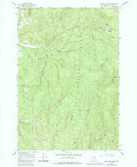
1965 Map of Limber Jim Creek
USGS Topo · Published 1985About this map
The Grande Ronde River carves through the heart of the Whitman National Forest in this mid-1960s survey, updated with revisions from the early 1980s. This high-altitude terrain in Union County is defined by the drainage of Limber Jim Creek and its forks, which gather at Limber Jim Meadow before joining the main river. The landscape bears clear evidence of industrial history, particularly the extractive operations focused on the south and east. Historic workings such as the Camp Carson Mine and Aurelia Mine are documented alongside extensive tailings and numerous scattered prospects. Remote high-country access is indicated by a network of jeep trails and a pack trail following the river. Notable landmarks like Marion Lake and Erickson Lake sit near the northern boundary, while lower elevations are marked by dozens of small gravel pits, reflecting the infrastructure needs of this timber and mining region.
Find a feature on this map
30 named features on this map. Tap any name to fly to it.
Don’t see what you’re looking for? This feature index may not catch every label — zoom into the map to look around manually.
Map Details
Editions of this 1965 Limber Jim Creek Map
3 editions found
Other maps of this area

1901 · Sumpter
USGS Topo · 1:125,000

1953 · Pendleton
USGS Topo · 1:250,000

1955 · Canyon City
USGS Topo · 1:250,000

1956 · Pendleton
USGS Topo · 1:250,000

1959 · Canyon City
USGS Topo · 1:250,000

1965 · Limber Jim Creek
USGS Topo · 1:24,000

1965 · Marley Creek
USGS Topo · 1:24,000

1965 · Anthony Butte
USGS Topo · 1:24,000

1965 · Little Beaver Creek
USGS Topo · 1:24,000
1965 · La Grande Reservoir
USGS Topo · 1:24,000