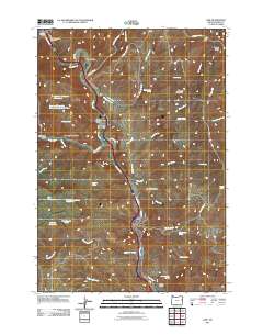
2011 Map of Lime
USGS Topo · Published 2011About this map
The Burnt River canyon dictates the movement of people and commerce through this corner of Baker County, Oregon. In 2011, the communities of Lime, Dixie, and Weatherby followed the winding path of the river, which is paralleled by major transportation infrastructure. The landscape is characterized by its high-desert water management, as evidenced by features like Triangle Reservoir, Juniper Mountain Waterhole, and Watering Trough Draw. Local history is anchored at the Lime-Dixie Cemetery, while names like Arrastra Gulch and Caribou Bar suggest the area's legacy of resource extraction. In the eastern portion of the map, the terrain rises toward Morgan Mountain, punctuated by remote springs such as Montezuma Spring and Benson Spring.
Find a feature on this map
52 named features on this map. Tap any name to fly to it.
Don’t see what you’re looking for? This feature index may not catch every label — zoom into the map to look around manually.
Map Details
Editions of this 2011 Lime Map
This is the sole edition of this map. No revisions or reprints were ever made.
Other maps of this area

1915 · Pine
USGS Topo · 1:125,000

1951 · Huntington
USGS Topo · 1:62,500

1952 · Olds Ferry NW
USGS Topo · 1:24,000

1952 · Olds Ferry
USGS Topo · 1:24,000

1952 · Olds Ferry
USGS Topo · 1:62,500

1955 · Baker
USGS Topo · 1:250,000

1957 · Durkee
USGS Topo · 1:62,500

1957 · Mineral
USGS Topo · 1:62,500

1959 · Baker
USGS Topo · 1:250,000

1980 · Brogan
USGS Topo · 1:100,000