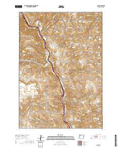
2020 Map of Lime
USGS Topo · Published 2020About this map
Lime and Weatherby anchor this Baker County corridor where the Burnt River carves a path through the high desert terrain. The landscape is defined by its water sources, with numerous named springs such as Walnut Spring, Smith Spring, and Lucky Spring scattered across the slopes of Weatherby Mtn and Morgan Mtn. This map documents a region with deep ties to western transit, notably along Oregon Trail Blvd and the path of modern transport that follows the river's natural canyon.
Find a feature on this map
93 named features on this map. Tap any name to fly to it.
Don’t see what you’re looking for? This feature index may not catch every label — zoom into the map to look around manually.
Map Details
Editions of this 2020 Lime Map
This is the sole edition of this map. No revisions or reprints were ever made.
Other maps of this area

1915 · Pine
USGS Topo · 1:125,000

1951 · Huntington
USGS Topo · 1:62,500

1952 · Olds Ferry NW
USGS Topo · 1:24,000

1952 · Olds Ferry
USGS Topo · 1:24,000

1952 · Olds Ferry
USGS Topo · 1:62,500

1955 · Baker
USGS Topo · 1:250,000

1957 · Durkee
USGS Topo · 1:62,500

1957 · Mineral
USGS Topo · 1:62,500

1959 · Baker
USGS Topo · 1:250,000

1980 · Brogan
USGS Topo · 1:100,000