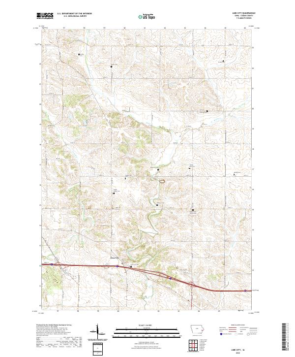
2022 Map of Lime City
USGS Topo · Published 2022About this map
Lime City and the small crossroads of Centerville anchor this portion of Cedar County, where the landscape is defined by the winding paths of Sugar Creek and Crooked Creek. The map reveals a high density of rural burial grounds, suggesting a long history of family homesteads and early pioneer settlements. Notable sites for genealogical research include Bradley Cemetery, South Bethel Cemetery, and Ochiltree Cemetery, alongside the Sugar Creek Church Cemetery. These landmarks are connected by a grid of rural roads like Monroe Road and Maurer Spicer Avenue that navigate around local water features such as Koch Lake and the Cedar Lakes. The geography illustrates a late 20th and early 21st-century rural Iowa landscape where small clusters of habitation persist among established agricultural sections and wooded creek beds.
Find a feature on this map
56 named features on this map. Tap any name to fly to it.
Don’t see what you’re looking for? This feature index may not catch every label — zoom into the map to look around manually.
Map Details
Editions of this 2022 Lime City Map
This is the sole edition of this map. No revisions or reprints were ever made.
Other maps of this area

1889 · Tipton
USGS Topo · 1:62,500

1890 · Durant
USGS Topo · 1:62,500

1890 · Tipton
USGS Topo · 1:62,500

1891 · Wilton Junction
USGS Topo · 1:62,500

1892 · Wheatland
USGS Topo · 1:62,500

1894 · Wheatland
USGS Topo · 1:62,500

1894 · Durant
USGS Topo · 1:62,500

1901 · Rock Island
USGS Topo · 1:125,000

1901 · Stanwood
USGS Topo · 1:125,000

1910 · Rock Island
USGS Topo · 1:125,000