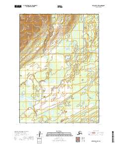
2019 Map of Lime Hills A-3 SW
USGS Topo · Published 2019About this map
Lake Clark National Preserve dominates the southern landscape of this remote Alaskan terrain, where glacial waters and complex drainage patterns define the geography. The meandering course of the Stony River serves as the primary hydrological artery, winding through a valley of wetlands and shifting bars. It is joined by the Necons River in the south and Kristin Creek flowing from the north, illustrating the dense network of tributaries that feed this wilderness region. The map reveals the intricate braided nature of these river systems within the Bethel Census Area, highlighting a landscape largely untouched by permanent roads or infrastructure. This 2019 survey provides a precise look at the seasonal floodplains and the high-elevation contours of the surrounding hills, marking the intersection of Township 11 North and Township 12 North.
Find a feature on this map
9 named features on this map. Tap any name to fly to it.
Don’t see what you’re looking for? This feature index may not catch every label — zoom into the map to look around manually.
Map Details
Editions of this 2019 Lime Hills A-3 SW Map
This is the sole edition of this map. No revisions or reprints were ever made.
Other maps of this area

1946 · Lake Clark
USGS Topo · 1:250,000

1951 · Lake Clark
USGS Topo · 1:250,000

1951 · Lime Hills
USGS Topo · 1:250,000

1954 · Lime Hills A-3
USGS Topo · 1:63,360

1954 · Lake Clark D-3
USGS Topo · 1:63,360

1954 · Lime Hills A-4
USGS Topo · 1:63,360

1954 · Lake Clark D-4
USGS Topo · 1:63,360

1958 · Lake Clark
USGS Topo · 1:250,000

1958 · Lime Hills
USGS Topo · 1:250,000
2018 · Lake Clark D-4 NE
USGS Topo · 1:25,000