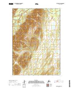
2019 Map of Lime Hills C-5 NW
USGS Topo · Published 2019About this map
Gagaryah River defines the northwestern corner of this remote Alaskan interior, while the headwaters of the Babel River touch the southeastern edge. This terrain is marked by dramatic elevation changes, where high-country ridges and deep valleys are defined by precise 20-foot contour intervals. Situated within the Bethel Census Area, the landscape reflects the raw hydrology of the region before any modern road networks or permanent settlements were established. The presence of the Gagaryah River indicates a vital corridor for travel and survival in a wilderness dominated by township divisions like t19n r31w and t19n r30w. For those studying the hydrology and untouched topography of the Lime Hills, this survey provides a clean look at the land's natural drainage patterns.
Find a feature on this map
6 named features on this map. Tap any name to fly to it.
Don’t see what you’re looking for? This feature index may not catch every label — zoom into the map to look around manually.
Map Details
Editions of this 2019 Lime Hills C-5 NW Map
This is the sole edition of this map. No revisions or reprints were ever made.
Other maps of this area

1951 · Lime Hills
USGS Topo · 1:250,000

1954 · Lime Hills D-6
USGS Topo · 1:63,360

1954 · Lime Hills D-5
USGS Topo · 1:63,360

1954 · Lime Hills C-6
USGS Topo · 1:63,360
1954 · Lime Hills C-5
USGS Topo · 1:63,360

1958 · Lime Hills
USGS Topo · 1:250,000
2019 · Lime Hills D-5 SE
USGS Topo · 1:25,000
2019 · Lime Hills D-5 SW
USGS Topo · 1:25,000
2019 · Lime Hills C-5 SW
USGS Topo · 1:25,000
2019 · Lime Hills C-6 NE
USGS Topo · 1:25,000