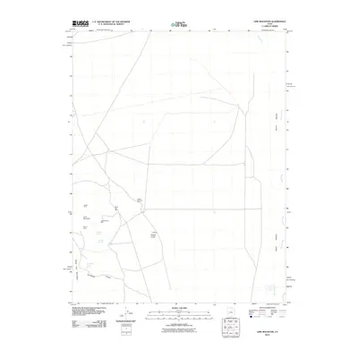
2010 Map of Lime Mountain
USGS Topo · Published 2010About this map
Galena Mine and the North Star Mine are prominent features in this high-desert mining landscape, where early 21st-century topography reveals a complex network of resource extraction. The map details a series of workings clustered around Lime Mountain, including the Skylark Mine and Independence Mine, which speak to the area's mineral prospects. To the east, the Beaver River Bottoms provide a stark contrast to the arid elevations of the Beaver Lake Mountains. This quadrangle is particularly useful for locating remote water sources such as Douglas Spring, Bardsley Spring, and the uniquely named Brounfield Tunnel Spring. The terrain transitions from the rugged Brownfield Canyon to the distinct elevations of Badger Knolls and Copper Mountain Mine, tracing the intersection of geology and industry in Millard County.
Find a feature on this map
16 named features on this map. Tap any name to fly to it.
Don’t see what you’re looking for? This feature index may not catch every label — zoom into the map to look around manually.
Map Details
Editions of this 2010 Lime Mountain Map
This is the sole edition of this map. No revisions or reprints were ever made.
Other maps of this area

1885 · Beaver
USGS Topo · 1:250,000

1953 · Richfield
USGS Topo · 1:250,000

1958 · Richfield
USGS Topo · 1:250,000

1958 · Milford
USGS Topo · 1:62,500

1958 · Milford
USGS Topo · 1:24,000

1958 · Adamsville
USGS Topo · 1:62,500

1958 · Ranch Canyon
USGS Topo · 1:24,000

1960 · Beaver Lake Mts.
USGS Topo · 1:62,500

1973 · Black Rock
USGS Topo · 1:24,000

1973 · Read
USGS Topo · 1:24,000