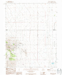
1989 Map of Lime Mountain
USGS Topo · Published 1989About this map
Lime Mountain and the surrounding high desert terrain in Beaver County define this area of intensive mineral exploration and geological study. The landscape is marked by a dense network of mining features, including the Copper Mountain Mine and an Open Pit Mine, alongside numerous Mine Shafts and scattered Prospects. These industrial markings contrast with the natural water sources that have long served this arid region, such as Douglas Spring, Bardsley Spring, and Smith Spring.
Find a feature on this map
22 named features on this map. Tap any name to fly to it.
Don’t see what you’re looking for? This feature index may not catch every label — zoom into the map to look around manually.
Map Details
Editions of this 1989 Lime Mountain Map
This is the sole edition of this map. No revisions or reprints were ever made.
Other maps of this area

1885 · Beaver
USGS Topo · 1:250,000

1953 · Richfield
USGS Topo · 1:250,000

1958 · Richfield
USGS Topo · 1:250,000

1958 · Milford
USGS Topo · 1:62,500

1958 · Milford
USGS Topo · 1:24,000

1958 · Adamsville
USGS Topo · 1:62,500

1958 · Ranch Canyon
USGS Topo · 1:24,000

1960 · Beaver Lake Mts.
USGS Topo · 1:62,500

1973 · Black Rock
USGS Topo · 1:24,000

1973 · Read
USGS Topo · 1:24,000