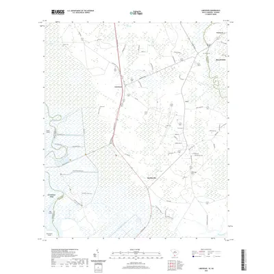
2020 Map of Limehouse
USGS Topo · Published 2020About this map
Savannah NWR dominates the western reaches of this Lowcountry survey, where the Little Back River and Union River wind through a complex system of islands and wetlands. The map details the transition from the marshy environs of Argyle Island and Hog Island to the inland settlements of Limehouse and Levy. This area of Jasper and Beaufort counties is characterized by a high concentration of small, family-named burial grounds, including Chisolm Cem, Pelot Cem, and Hardy Cem, which offer significant genealogical value for local researchers. The landscape is interconnected by a network of historic plantation trails and modern corridors like Speedway Blvd. Strategic water passages such as the Lucknow Canal and Murray Hill Canal underscore the long-standing efforts to manage the tidal flow near Cross Tides and the Wright River, reflecting the region's agricultural and maritime legacy.
Find a feature on this map
73 named features on this map. Tap any name to fly to it.
Don’t see what you’re looking for? This feature index may not catch every label — zoom into the map to look around manually.
Map Details
Editions of this 2020 Limehouse Map
This is the sole edition of this map. No revisions or reprints were ever made.
Other maps of this area

1920 · Hardeeville
USGS Topo · 1:62,500

1920 · Okatie
USGS Topo · 1:62,500

1920 · Bluffton
USGS Topo · 1:62,500

1942 · Savannah
USGS Topo · 1:62,500

1942 · Okatie
USGS Topo · 1:62,500

1943 · Hardeeville
USGS Topo · 1:62,500

1945 · Bluffton
USGS Topo · 1:62,500

1947 · Savannah
USGS Topo · 1:250,000

1948 · Savannah
USGS Topo · 1:250,000

1953 · Hardeeville
USGS Topo · 1:62,500