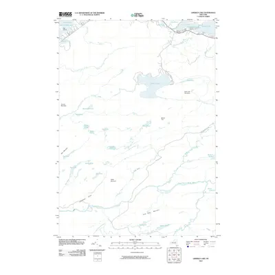
2010 Map of Limekiln Lake
USGS Topo · Published 2010About this map
Limekiln Lake and the Fulton Chain Lakes anchor this landscape of the western Adirondacks, where a dense network of water bodies and high peaks defines the terrain. The northern edge of the map features a string of interconnected waters including Fourth Lake, Fifth Lake, and Seventh Lake, with Big Island prominently situated in the northwestern corner. This area shows light development along the shorelines, particularly along S Shore Rd and Sixth Lake Rd.
Find a feature on this map
49 named features on this map. Tap any name to fly to it.
Don’t see what you’re looking for? This feature index may not catch every label — zoom into the map to look around manually.
Map Details
Editions of this 2010 Limekiln Lake Map
This is the sole edition of this map. No revisions or reprints were ever made.
Other maps of this area

1900 · Canada Lake
USGS Topo · 1:62,500

1901 · Old Forge
USGS Topo · 1:62,500

1903 · Big Moose
USGS Topo · 1:62,500

1903 · West Canada Lakes
USGS Topo · 1:62,500

1903 · Raquette Lake
USGS Topo · 1:62,500

1950 · Utica
USGS Topo · 1:250,000

1954 · Old Forge
USGS Topo · 1:62,500

1954 · West Canada Lakes
USGS Topo · 1:62,500
1954 · Raquette Lake
USGS Topo · 1:62,500

1954 · Big Moose
USGS Topo · 1:62,500