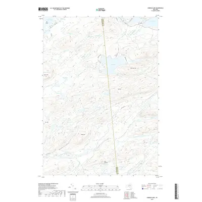
2019 Map of Limekiln Lake
USGS Topo · Published 2019About this map
Adirondack Park defines this landscape where Herkimer and Hamilton counties meet, centered on the significant basin of Limekiln Lake. The interior is defined by a complex network of high-elevation water bodies and drainage systems, including Limekiln Swamp and the headwaters of Limekiln Creek. To the north, the map shows the transition into the Fulton Chain Lakes system with portions of Seventh Lake and Fifth Lake visible. Notable peaks like Higley Mtn, Fernow Mtn, and Pico Mtn rise above a series of remote waters such as Mitchell Ponds and the aptly named Deadmans Gulch. The road network is limited to the periphery, with routes like Indian Lake Rd and Campsite Rd providing the only modern access points into this heavily forested terrain, where elevations frequently exceed 2,400 feet.
Find a feature on this map
59 named features on this map. Tap any name to fly to it.
Don’t see what you’re looking for? This feature index may not catch every label — zoom into the map to look around manually.
Map Details
Editions of this 2019 Limekiln Lake Map
This is the sole edition of this map. No revisions or reprints were ever made.
Other maps of this area

1900 · Canada Lake
USGS Topo · 1:62,500

1901 · Old Forge
USGS Topo · 1:62,500

1903 · Big Moose
USGS Topo · 1:62,500

1903 · West Canada Lakes
USGS Topo · 1:62,500

1903 · Raquette Lake
USGS Topo · 1:62,500

1950 · Utica
USGS Topo · 1:250,000

1954 · Old Forge
USGS Topo · 1:62,500

1954 · West Canada Lakes
USGS Topo · 1:62,500
1954 · Raquette Lake
USGS Topo · 1:62,500

1954 · Big Moose
USGS Topo · 1:62,500