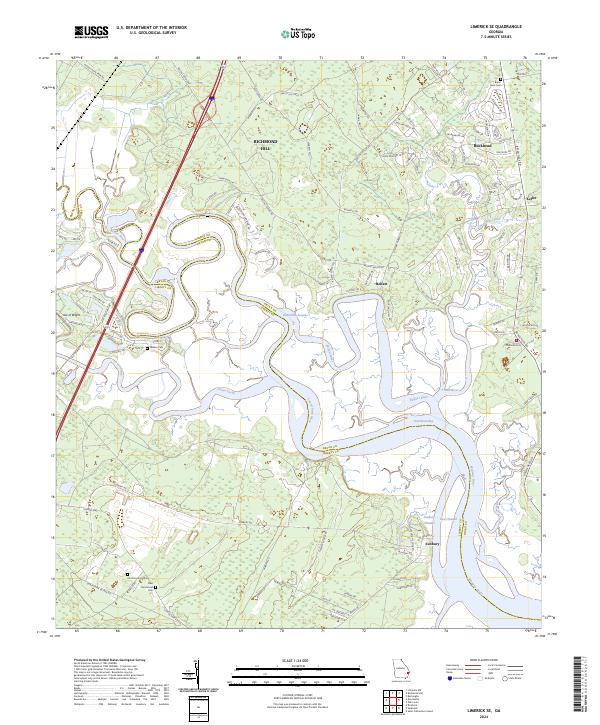
2024 Map of Limerick SE
USGS Topo · Published 2024About this map
Richmond Hill and the coastal lowlands of coastal Georgia meet in this detailed survey, where the winding channels of the Medway River and Belfast River define the landscape. The geography is characterized by a complex network of tidal waterways, including Buttermilk Sound and Jones Creek, which separate established inland settlements from islands like Isle of Wight. This area maintains a strong connection to its early history through several well-preserved landmarks. For genealogists and local researchers, the presence of the Bryan Neck Cem and the Old Dorchester Cem alongside the New Dorchester Cem provides important anchors for family history near the historic settlement of Sunbury. This port town, located along the Sunbury Channel, sits at the edge of the East Channel, illustrating the enduring importance of the maritime economy to the Bryan and Liberty County border region.
Find a feature on this map
115 named features on this map. Tap any name to fly to it.
Don’t see what you’re looking for? This feature index may not catch every label — zoom into the map to look around manually.
Map Details
Editions of this 2024 Limerick SE Map
This is the sole edition of this map. No revisions or reprints were ever made.
Other maps of this area

1920 · Sapelo River
USGS Topo · 1:62,500

1920 · Limerick
USGS Topo · 1:62,500

1928 · St Catherines Island
USGS Topo · 1:62,500

1943 · St Catherines Island
USGS Topo · 1:62,500

1943 · Sapelo River
USGS Topo · 1:62,500

1944 · Limerick
USGS Topo · 1:62,500

1944 · Ossabaw Island
USGS Topo · 1:62,500

1945 · St. Catherine's Island
USGS Topo · 1:62,500

1945 · Ossabaw Island
USGS Topo · 1:62,500

1945 · Sapelo River
USGS Topo · 1:62,500