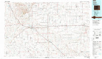
1984 Map of Limon
USGS Topo · Published 1984About this map
Limon serves as the central hub of this eastern Colorado landscape, where the Union Pacific railroad and major highways converge near the junction of several drainage systems. Compiled from data recorded between 1970 and 1980, the map illustrates a region defined by its aviation and transit infrastructure, featuring Limon Municipal Airport, Hugo Municipal Airport, and the Flagler Aviation Service near the eastern margin. The settlement pattern follows the rail and river corridors, with small communities like River Bend, Genoa, and Arriba lining the path through the plains.
Find a feature on this map
47 named features on this map. Tap any name to fly to it.
Don’t see what you’re looking for? This feature index may not catch every label — zoom into the map to look around manually.
Map Details
Editions of this 1984 Limon Map
This is the sole edition of this map. No revisions or reprints were ever made.
Other maps of this area

1889 · Sanborn
USGS Topo · 1:125,000

1891 · Sanborn
USGS Topo · 1:125,000

1891 · Arroyo
USGS Topo · 1:125,000

1891 · Kit Carson
USGS Topo · 1:125,000

1891 · Limon
USGS Topo · 1:125,000

1892 · Limon
USGS Topo · 1:125,000

1893 · Arroyo
USGS Topo · 1:125,000

1893 · Kit Carson
USGS Topo · 1:125,000

1893 · Sanborn
USGS Topo · 1:125,000

1893 · Big Springs
USGS Topo · 1:125,000