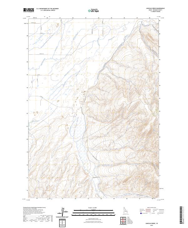
2023 Map of Lincoln Creek
USGS Topo · Published 2023About this map
Lincoln Creek Valley serves as a central geographical feature in this part of Bingham County, where the high desert meets a complex network of irrigation and natural watercourses. The Blackfoot River meanders across the landscape, joined by a sophisticated system of water management including the West Branch Snake River Valley Canal, the Reservation Canal, and various agricultural lifelines like Taylor Ditch and Hanson Ditch.
Find a feature on this map
31 named features on this map. Tap any name to fly to it.
Don’t see what you’re looking for? This feature index may not catch every label — zoom into the map to look around manually.
Map Details
Editions of this 2023 Lincoln Creek Map
This is the sole edition of this map. No revisions or reprints were ever made.
Other maps of this area

1940 · Blackfoot
USGS Topo · 1:62,500

1943 · Blackfoot
USGS Topo · 1:62,500

1950 · Goshen
USGS Topo · 1:24,000

1951 · Higham Peak
USGS Topo · 1:24,000

1952 · Goshen
USGS Topo · 1:24,000

1955 · Lincoln Creek
USGS Topo · 1:24,000

1955 · Rose
USGS Topo · 1:24,000

1955 · Firth
USGS Topo · 1:24,000

1955 · Yandell Springs
USGS Topo · 1:62,500

1955 · Idaho Falls
USGS Topo · 1:250,000