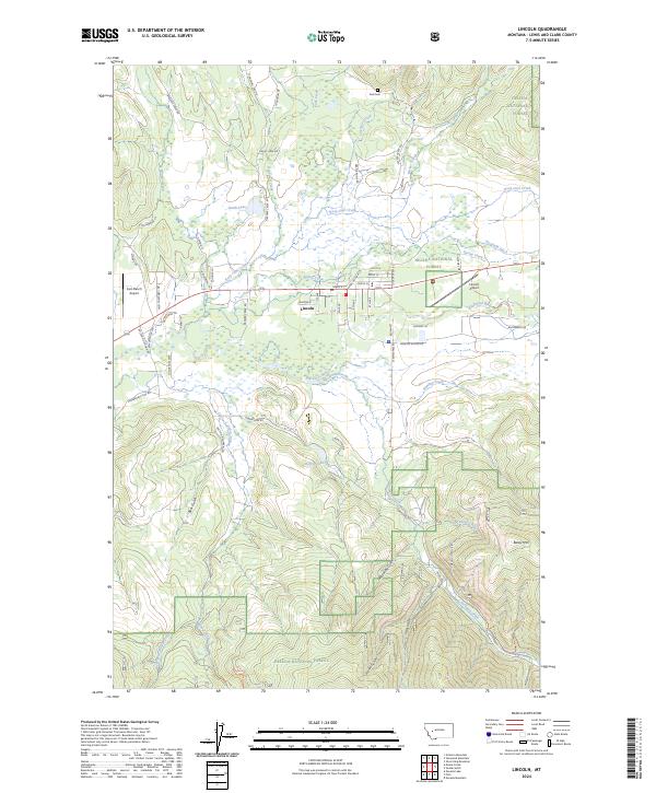
2024 Map of Lincoln
USGS Topo · Published 2024About this map
The town of Lincoln serves as a central hub in this mountain valley, situated at the confluence of the Blackfoot River and several tributary streams. Modern infrastructure is represented by the Lincoln Airport and the smaller Cain Ranch Airport, while local history is anchored by the Tuck Cem to the north. The landscape transition is stark, moving from the developed valley floor near Main St to the protected wilderness of the Helena National Forest and the Blackfoot Valley Conservation Area. Numerous gulches and creeks, such as McCarthy Gulch and Keep Cool Creek, carve through the terrain toward Baldy Mtn. The presence of the Grosfield Ditch and various named lakes like Smith Lake indicates a landscape heavily managed for water resources and conservation in the 21st century.
Find a feature on this map
69 named features on this map. Tap any name to fly to it.
Don’t see what you’re looking for? This feature index may not catch every label — zoom into the map to look around manually.
Map Details
Editions of this 2024 Lincoln Map
This is the sole edition of this map. No revisions or reprints were ever made.
Other maps of this area

1889 · Helena
USGS Topo · 1:250,000

1893 · Helena
USGS Topo · 1:250,000

1899 · Helena
USGS Topo · 1:250,000

1903 · Coopers Lake
USGS Topo · 1:125,000

1903 · Helena
USGS Topo · 1:250,000

1947 · Butte
USGS Topo · 1:250,000

1955 · Choteau
USGS Topo · 1:250,000

1957 · Choteau
USGS Topo · 1:250,000

1958 · Butte
USGS Topo · 1:250,000

1958 · Choteau
USGS Topo · 1:250,000