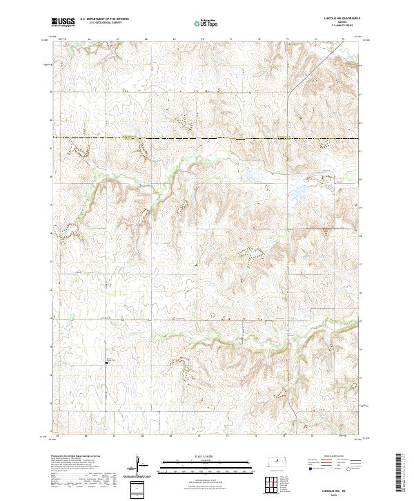
2022 Map of Lincoln NW
USGS Topo · Published 2022About this map
The boundary between Mitchell Co and Lincoln Co bisects this Kansas landscape, defined by a network of drainage systems and rural section roads. The terrain is deeply etched by watercourses including Rattlesnake Cr and Battle Cr, which create a complex topography of ridges and draws characteristic of the region's upland plains. Local transportation follows the established grid of the Public Land Survey System, with routes such as Ash Grove Rd and E Union Dr providing access to the agricultural interior. Near the center of the southern portion, Prairie Grove Cem serves as a significant landmark for genealogical research, anchoring the local history of the surrounding townships. The map documents the persistent rural character of these counties, where smaller streams like Little Timber Cr and Salt Cr feed into the larger hydrological basin.
Find a feature on this map
20 named features on this map. Tap any name to fly to it.
Don’t see what you’re looking for? This feature index may not catch every label — zoom into the map to look around manually.
Map Details
Editions of this 2022 Lincoln NW Map
This is the sole edition of this map. No revisions or reprints were ever made.
Other maps of this area

1894 · Beloit
USGS Topo · 1:125,000

1955 · Beloit
USGS Topo · 1:250,000

1959 · Beloit
USGS Topo · 1:250,000

1962 · Vesper
USGS Topo · 1:24,000

1962 · Lincoln
USGS Topo · 1:24,000
1963 · Shady Bend
USGS Topo · 1:24,000
1964 · Barnard
USGS Topo · 1:24,000
1964 · Beloit SE
USGS Topo · 1:24,000

1968 · Beloit SW
USGS Topo · 1:24,000

1968 · Lincoln NW
USGS Topo · 1:24,000