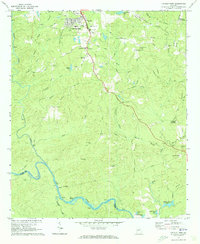
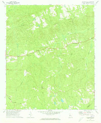
1971 Map of Lincoln Park
USGS Topo · Published 1973About this map
The Flint River winds along the southern boundary of Upson County in this early 1970s record, passing through several distinctive Shoals and Snipes Shoals. The landscape north of the river is defined by a network of rural settlements and named crossroads, including Lincoln Park, Redbone Crossroads, and Birdsong Crossroads. The terrain is marked by notable geological features like Snipes Grave Rock and Ten Acre Rock, while several small lakes, including Mathis Lake and Wiggam Branch Lake, dot the creekside basins. This era shows a community rooted in local industry and faith, evidenced by the Mica Pit and numerous country churches such as Zion Chapel and Welcome Grove Ch. The presence of the Vocational Sch and the Radio Tower (WSFT) reflects the mid-century development of the Thomaston area, while older landmarks like Southview Cem provide points of reference for genealogists.
Find a feature on this map
61 named features on this map. Tap any name to fly to it.
Don’t see what you’re looking for? This feature index may not catch every label — zoom into the map to look around manually.
Map Details
Editions of this 1971 Lincoln Park Map
2 editions found
Other maps of this area

1935 · Thomaston
USGS Topo · 1:48,000

1939 · Thomaston
USGS Topo · 1:62,500

1951 · Yatesville
USGS Topo · 1:62,500

1955 · Phenix City
USGS Topo · 1:250,000

1957 · Phenix City
USGS Topo · 1:250,000

1958 · Phenix City
USGS Topo · 1:250,000
1971 · Sunset Village
USGS Topo · 1:24,000
1971 · Roland
USGS Topo · 1:24,000

1971 · Prattsburg
USGS Topo · 1:24,000
1971 · Baldwinville
USGS Topo · 1:24,000