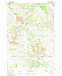
1981 Map of Lincoln Peak
USGS Topo · Published 1981About this map
Industrial activity and water resources define this corner of the Fort Hall Indian Reservation in Idaho. The prominent footprint of the Gay Mine dominates several sections, showing extensive excavation areas and access infrastructure like the Union Pacific railroad line and a dedicated Landing Strip. These features reflect the mid-to-late 20th-century phosphate mining operations that once operated on Shoshone-Bannock tribal lands.
Find a feature on this map
38 named features on this map. Tap any name to fly to it.
Don’t see what you’re looking for? This feature index may not catch every label — zoom into the map to look around manually.
Map Details
Editions of this 1981 Lincoln Peak Map
This is the sole edition of this map. No revisions or reprints were ever made.
Other maps of this area

1917 · Portneuf
USGS Topo · 1:62,500

1918 · Paradise Valley
USGS Topo · 1:62,500

1951 · Higham Peak
USGS Topo · 1:24,000

1954 · Pocatello
USGS Topo · 1:250,000

1955 · Lincoln Creek
USGS Topo · 1:24,000

1955 · Yandell Springs
USGS Topo · 1:62,500

1955 · Idaho Falls
USGS Topo · 1:250,000

1955 · Driggs
USGS Topo · 1:250,000

1955 · Preston
USGS Topo · 1:250,000

1958 · Driggs
USGS Topo · 1:250,000