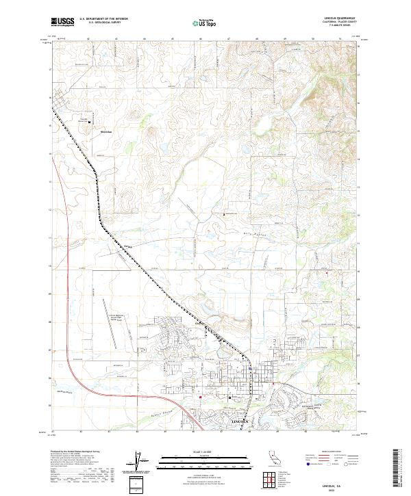
2022 Map of Lincoln
USGS Topo · Published 2022About this map
Lincoln sits at the heart of this landscape, where the Sierra Nevada foothills meet the Sacramento Valley. The town's grid is flanked by significant water management and drainage features, including the Lincoln Canal, Auburn Ravine, and Ingram Slough. To the north, the smaller settlements of Clayton, Ewing, and Sheridan punctuate a terrain defined by agricultural blocks and ranch roads.
Find a feature on this map
132 named features on this map. Tap any name to fly to it.
Don’t see what you’re looking for? This feature index may not catch every label — zoom into the map to look around manually.
Map Details
Editions of this 2022 Lincoln Map
This is the sole edition of this map. No revisions or reprints were ever made.
Other maps of this area

1888 · Smartsville
USGS Topo · 1:125,000

1891 · Sacramento
USGS Topo · 1:125,000

1891 · Smartsville
USGS Topo · 1:125,000

1892 · Sacramento
USGS Topo · 1:125,000

1892 · Smartsville
USGS Topo · 1:125,000

1893 · Sacramento
USGS Topo · 1:125,000

1894 · Smartsville
USGS Topo · 1:125,000

1895 · Smartsville
USGS Topo · 1:125,000

1910 · Sheridan
USGS Topo · 1:31,680

1910 · Lincoln
USGS Topo · 1:31,680