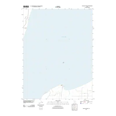
2011 Map of Lincoln Point
USGS Topo · Published 2011About this map
Utah Lake dominates the geography of this quadrangle, defining the shoreline where the freshwater expanse meets the southern Utah Valley. The prominent landform of Lincoln Point projects into the water, serving as a landmark between the main body of the lake and the marshier reaches of Benjamin Slough to the east. Along the western edge, the coastline is indented by Little Cove and Big Cove, where the terrain rises quickly from the water's edge. A small, isolated landmark, Bird Island, sits well offshore, highlighting the lake's topography. Transportation in the early 21st century follows the contours of the coast via S Lincoln Beach Dr and Lincoln Bch, while a rigid grid of local roads like W 5200 S and W 5400 S begins to reach toward the shoreline from the southeast, marking the interface between the lake and agricultural or residential development.
Find a feature on this map
11 named features on this map. Tap any name to fly to it.
Don’t see what you’re looking for? This feature index may not catch every label — zoom into the map to look around manually.
Map Details
Editions of this 2011 Lincoln Point Map
This is the sole edition of this map. No revisions or reprints were ever made.
Other maps of this area

1885 · Salt Lake
USGS Topo · 1:250,000

1948 · Spanish Fork
USGS Topo · 1:24,000

1948 · Orem
USGS Topo · 1:24,000

1948 · Orem
USGS Topo · 1:62,500

1948 · Provo
USGS Topo · 1:24,000

1949 · Provo
USGS Topo · 1:62,500

1950 · Orem
USGS Topo · 1:24,000

1950 · Provo
USGS Topo · 1:24,000

1950 · Spanish Fork
USGS Topo · 1:24,000

1950 · West Mountain
USGS Topo · 1:24,000