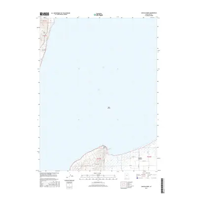
2017 Map of Lincoln Point
USGS Topo · Published 2017About this map
Utah Lake dominates the center of this sheet, covering the vast majority of the quadrangle and emphasizing the importance of the shoreline to local development. Along the southern edge, the terrain rises sharply at West Mtn, where the elevation provides a backdrop for the community of Lake Shore. This area is characterized by a transition from the water's edge at Lincoln Point to the agricultural grid system of local roads like W 5200 S St and S 4600 W. The eastern shoreline is further defined by the mouth of Benjamin Slough, which feeds into the lake. On the western shore, the landscape is marked by small coastal features including Little Cove and Big Cove. These geological points, along with the isolated Bird Island in the lake's southern reach, illustrate a coastline defined by both significant elevation changes and low-lying marshy interfaces.
Find a feature on this map
18 named features on this map. Tap any name to fly to it.
Don’t see what you’re looking for? This feature index may not catch every label — zoom into the map to look around manually.
Map Details
Editions of this 2017 Lincoln Point Map
This is the sole edition of this map. No revisions or reprints were ever made.
Other maps of this area

1885 · Salt Lake
USGS Topo · 1:250,000

1948 · Spanish Fork
USGS Topo · 1:24,000

1948 · Orem
USGS Topo · 1:24,000

1948 · Orem
USGS Topo · 1:62,500

1948 · Provo
USGS Topo · 1:24,000

1949 · Provo
USGS Topo · 1:62,500

1950 · Orem
USGS Topo · 1:24,000

1950 · Provo
USGS Topo · 1:24,000

1950 · Spanish Fork
USGS Topo · 1:24,000

1950 · West Mountain
USGS Topo · 1:24,000