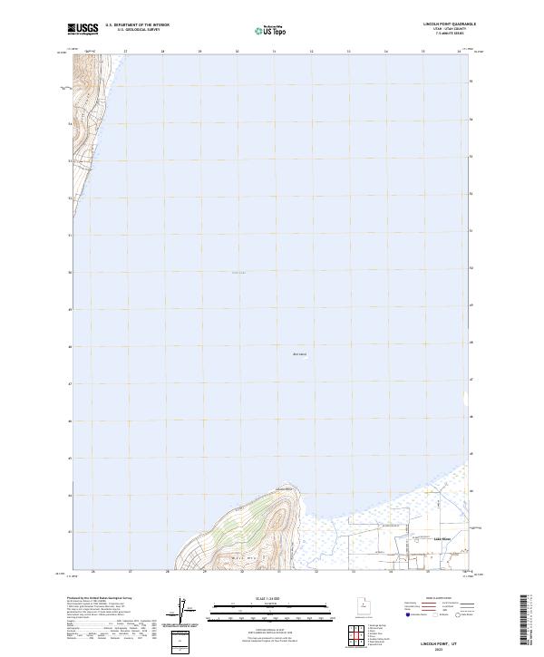
2023 Map of Lincoln Point
USGS Topo · Published 2023About this map
Utah Lake dominates this southern Utah landscape, where the waters meet the northern slopes of West Mtn. The shoreline is defined by several distinct geographical features, most notably Lincoln Point and the secluded Little Cove at the foot of the mountain range. Near the center of the lake, Bird Island sits as a solitary landmark in the open water. The southeastern corner shows the transition from the lake's edge to the agricultural settlement of Lake Shore, where a grid of local roads like W 5200 South St and S 4800 West St support the local community. The presence of Lincoln Beach Rd running along the coast indicates the continued accessibility and utility of the waterfront in this contemporary survey.
Find a feature on this map
14 named features on this map. Tap any name to fly to it.
Don’t see what you’re looking for? This feature index may not catch every label — zoom into the map to look around manually.
Map Details
Editions of this 2023 Lincoln Point Map
This is the sole edition of this map. No revisions or reprints were ever made.
Other maps of this area

1885 · Salt Lake
USGS Topo · 1:250,000

1948 · Spanish Fork
USGS Topo · 1:24,000

1948 · Orem
USGS Topo · 1:24,000

1948 · Orem
USGS Topo · 1:62,500

1948 · Provo
USGS Topo · 1:24,000

1949 · Provo
USGS Topo · 1:62,500

1950 · Orem
USGS Topo · 1:24,000

1950 · Provo
USGS Topo · 1:24,000

1950 · Spanish Fork
USGS Topo · 1:24,000

1950 · West Mountain
USGS Topo · 1:24,000