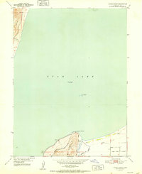
1952 Map of Lincoln Point
USGS Topo · Published 1952About this map
Utah Lake dominates this 1952 survey, providing a clear view of the shoreline and hydrology south of Lehi before extensive modern development. The prominence of West Mountain rises sharply at the southern edge, culminating at Lincoln Point, a notable landmark for both navigation and local geography. The map captures the lake's elevation at 4,487 feet as recorded in September 1949, reflecting post-war water levels.
Find a feature on this map
11 named features on this map. Tap any name to fly to it.
Don’t see what you’re looking for? This feature index may not catch every label — zoom into the map to look around manually.
Map Details
Editions of this 1952 Lincoln Point Map
This is the sole edition of this map. No revisions or reprints were ever made.
Other maps of this area

1885 · Salt Lake
USGS Topo · 1:250,000

1948 · Spanish Fork
USGS Topo · 1:24,000

1948 · Orem
USGS Topo · 1:24,000

1948 · Orem
USGS Topo · 1:62,500

1948 · Provo
USGS Topo · 1:24,000

1949 · Provo
USGS Topo · 1:62,500

1950 · Orem
USGS Topo · 1:24,000

1950 · Provo
USGS Topo · 1:24,000

1950 · Spanish Fork
USGS Topo · 1:24,000

1950 · West Mountain
USGS Topo · 1:24,000