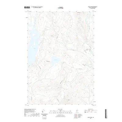
2021 Map of Lincoln Pond
USGS Topo · Published 2021About this map
Lincoln Pond and the surrounding peaks of Oxford County define this remote landscape in the Maine north woods. The territory is dominated by the high elevations of Big Buck Mtn and Deer Mtn, with the waters of Aziscohos Lake framing the western edge. This modern survey illustrates the network of timber and access roads, such as Cupsuptic Tote Rd and Lincoln Pond Rd, which have long supported the region's working forests. The drainage patterns are clearly marked by the Magalloway River and Cupsuptic River, including distinctive hydrological features like Big Falls. In the eastern section, specialized labels such as Toothaker Brook Number One and Fox Pond highlight the intricate waterway systems that feed into the larger river valleys.
Find a feature on this map
27 named features on this map. Tap any name to fly to it.
Don’t see what you’re looking for? This feature index may not catch every label — zoom into the map to look around manually.
Map Details
Editions of this 2021 Lincoln Pond Map
This is the sole edition of this map. No revisions or reprints were ever made.
Other maps of this area

1927 · Second Lake
USGS Topo · 1:62,500

1930 · Errol
USGS Topo · 1:62,500

1931 · Cupsuptic
USGS Topo · 1:48,000

1932 · Second Lake
USGS Topo · 1:62,500

1934 · Cupsuptic
USGS Topo · 1:62,500

1934 · Errol
USGS Topo · 1:62,500

1935 · Cupsuptic
USGS Topo · 1:62,500

1940 · Oquossoc
USGS Topo · 1:62,500

1942 · Oquossoc
USGS Topo · 1:62,500

1949 · Jackman
USGS Topo · 1:250,000
Featured Places
- Lincoln Plantation, ME
- Adamstown Township, ME
- Lynchtown Township, ME
- Upper Cupsuptic Township, ME
- Parkertown Township, ME