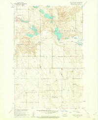
1960 Map of Lincoln Valley
USGS Topo · Published 1962About this map
The Sheyenne River winds through the heart of this Sheridan County landscape, where the prairie is punctuated by a dense network of early rural schoolhouses. At the crossroads of Lincoln Valley, the community was served by local institutions including the Lincoln Sch No 1 and Lincoln Sch No 4. This 1960 field check reveals a strictly organized township structure, with the northern section designated as New Germantown.
Find a feature on this map
14 named features on this map. Tap any name to fly to it.
Don’t see what you’re looking for? This feature index may not catch every label — zoom into the map to look around manually.
Map Details
Editions of this 1960 Lincoln Valley Map
2 editions found
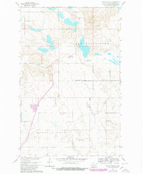
Other maps of this area

1930 · Drake
USGS Topo · 1:62,500

1940 · Aylmer
USGS Topo · 1:62,500

1946 · Sheyenne Lake
USGS Topo · 1:48,000

1947 · Lincoln Valley
USGS Topo · 1:62,500

1947 · Sheyenne Lake
USGS Topo · 1:62,500

1950 · Sheyenne Lake
USGS Topo · 1:24,000

1951 · Anamoose SW
USGS Topo · 1:24,000

1954 · McClusky
USGS Topo · 1:250,000

1958 · McClusky
USGS Topo · 1:250,000

1958 · Drake
USGS Topo · 1:62,500