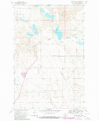
1960 Map of Lincoln Valley
USGS Topo · Published 1980About this map
Lincoln Valley serves as a focal point in this portion of Sheridan County, situated within the townships of Lincoln Dale and New Germantown. The landscape is defined by the winding course of the Sheyenne River, which cuts across the central section of the map, and a series of numerous small lakes and depressions characteristic of the regional prairie pothole topography.
Find a feature on this map
12 named features on this map. Tap any name to fly to it.
Don’t see what you’re looking for? This feature index may not catch every label — zoom into the map to look around manually.
Map Details
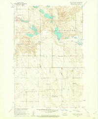
Editions of this 1960 Lincoln Valley Map
2 editions found
Other maps of this area

1930 · Drake
USGS Topo · 1:62,500

1940 · Aylmer
USGS Topo · 1:62,500

1946 · Sheyenne Lake
USGS Topo · 1:48,000

1947 · Lincoln Valley
USGS Topo · 1:62,500

1947 · Sheyenne Lake
USGS Topo · 1:62,500

1950 · Sheyenne Lake
USGS Topo · 1:24,000

1951 · Anamoose SW
USGS Topo · 1:24,000

1954 · McClusky
USGS Topo · 1:250,000

1958 · McClusky
USGS Topo · 1:250,000

1958 · Drake
USGS Topo · 1:62,500