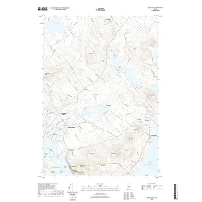
2018 Map of Lincolnville
USGS Topo · Published 2018About this map
Lincolnville Center and Drake Corner anchor this coastal Maine landscape, where the low-lying wetlands and ponds of the interior meet the high elevations of the Camden Hills. The terrain is marked by a transition from the agricultural and residential pockets near Youngtown to the prominent heights of Mt Megunticook and the sharp drop at Maiden Cliff. Waterways like the Ducktrap River wind through the valleys, connecting inland bodies like Pitcher Pond and Norton Pond toward the Atlantic Ocean at Ducktrap. Numerous small family and community burial grounds, such as Pitcher Cem and Maplewood Cem, are scattered along the rural road network, providing a clear view of the settlement patterns established long before this modern survey. The boundary between Waldo Co and Knox Co cuts across the southern portion of the quadrangle, dividing the peaks of Bald Rock Mtn and Cameron Mtn.
Find a feature on this map
119 named features on this map. Tap any name to fly to it.
Don’t see what you’re looking for? This feature index may not catch every label — zoom into the map to look around manually.
Map Details
Editions of this 2018 Lincolnville Map
This is the sole edition of this map. No revisions or reprints were ever made.
Other maps of this area

1902 · Castine
USGS Topo · 1:62,500

1904 · Castine
USGS Topo · 1:62,500

1904 · Vinalhaven
USGS Topo · 1:62,500

1904 · Rockland
USGS Topo · 1:62,500

1905 · Penobscot Bay
USGS Topo · 1:125,000

1906 · Rockland
USGS Topo · 1:62,500

1915 · Belfast
USGS Topo · 1:62,500

1917 · Belfast
USGS Topo · 1:62,500

1941 · Belfast
USGS Topo · 1:62,500

1941 · Rockland
USGS Topo · 1:62,500