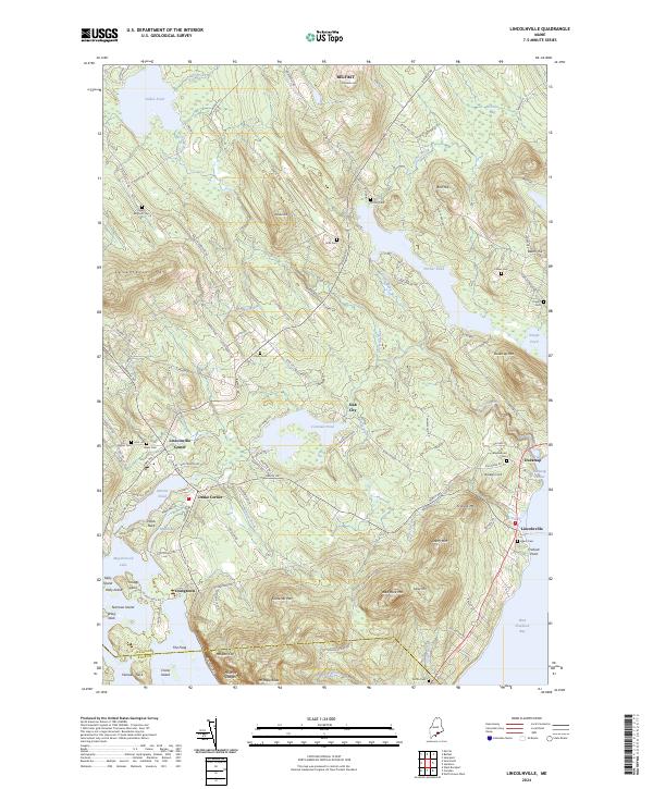
2024 Map of Lincolnville
USGS Topo · Published 2024About this map
Ducktrap Harbor and the surrounding Waldo County coastline reveal a landscape where tidal waters meet the high elevations of the Camden Hills. The settlement pattern is concentrated around several distinct hubs, including Lincolnville Center, Drake Corner, and the curiously named Slab City. Inland, the terrain is dominated by significant peaks such as Mt Megunticook and Bald Rock Mtn, which overlook Megunticook Lake and several coastal inlets. The map provides extensive detail for genealogists, with numerous family-named landmarks and small burial grounds like South Belmont Cem, Union Cem, and Pitcher Cem scattered across the interior hills and along the Ducktrap River. This geography highlights a rural coastal economy transitioned from historic maritime and timber activities to its modern role as a doorway to West Penobscot Bay.
Find a feature on this map
132 named features on this map. Tap any name to fly to it.
Don’t see what you’re looking for? This feature index may not catch every label — zoom into the map to look around manually.
Map Details
Editions of this 2024 Lincolnville Map
This is the sole edition of this map. No revisions or reprints were ever made.
Other maps of this area

1902 · Castine
USGS Topo · 1:62,500

1904 · Castine
USGS Topo · 1:62,500

1904 · Vinalhaven
USGS Topo · 1:62,500

1904 · Rockland
USGS Topo · 1:62,500

1905 · Penobscot Bay
USGS Topo · 1:125,000

1906 · Rockland
USGS Topo · 1:62,500

1915 · Belfast
USGS Topo · 1:62,500

1917 · Belfast
USGS Topo · 1:62,500

1941 · Belfast
USGS Topo · 1:62,500

1941 · Rockland
USGS Topo · 1:62,500