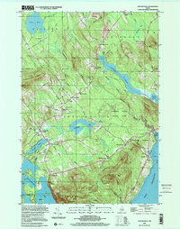
2000 Map of Lincolnville
USGS Topo · Published 2001About this map
The coastal and inland landscape of Lincolnville is defined by a dense network of family-named corners and crossroads that survived well into the late twentieth century. From Grange Corner in the north to Stevens Corner near the mountains, these points of reference anchor the rural topography of Waldo County. The interior is a mixture of water and wood, featuring significant bodies like Pitcher Pond and Norton Pond, while the eastern edge meets the salt water at Ducktrap Harbor.
Find a feature on this map
86 named features on this map. Tap any name to fly to it.
Don’t see what you’re looking for? This feature index may not catch every label — zoom into the map to look around manually.
Map Details
Editions of this 2000 Lincolnville Map
This is the sole edition of this map. No revisions or reprints were ever made.
Other maps of this area

1902 · Castine
USGS Topo · 1:62,500

1904 · Castine
USGS Topo · 1:62,500

1904 · Vinalhaven
USGS Topo · 1:62,500

1904 · Rockland
USGS Topo · 1:62,500

1905 · Penobscot Bay
USGS Topo · 1:125,000

1906 · Rockland
USGS Topo · 1:62,500

1915 · Belfast
USGS Topo · 1:62,500

1917 · Belfast
USGS Topo · 1:62,500

1941 · Belfast
USGS Topo · 1:62,500

1941 · Rockland
USGS Topo · 1:62,500