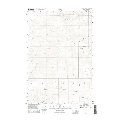
2014 Map of Lindemulder Hill
USGS Topo · Published 2014About this map
Lindemulder Hill and the surrounding high ground of Stillwater County define this prairie landscape, where a network of seasonal drainages carves through the undulating terrain. The drainage patterns of Kenyon Cr and Cottonwood Cr illustrate the watershed of this high plains region, while the prominent landmark of The Divide separates local catchments. A sparse but deliberate road network, including Stagecoach Rd and Rapelje Rd, follows the contours of the land, connecting remote ranchlands across multiple townships. Named summits like Pershing Hill, Busteed Hill, and Love Hill serve as navigational anchors in an area where the topography transitions between broad flats and dissected ridges. The map meticulously documents the section lines and township boundaries, such as t1n r19e, which are essential for tracing land ownership and early homestead boundaries in this part of Montana.
Find a feature on this map
25 named features on this map. Tap any name to fly to it.
Don’t see what you’re looking for? This feature index may not catch every label — zoom into the map to look around manually.
Map Details
Editions of this 2014 Lindemulder Hill Map
This is the sole edition of this map. No revisions or reprints were ever made.
Other maps of this area

1892 · Stillwater
USGS Topo · 1:125,000

1954 · Billings
USGS Topo · 1:250,000

1955 · Antelope Point
USGS Topo · 1:24,000

1955 · Springtime
USGS Topo · 1:24,000

1955 · Russell Gulch
USGS Topo · 1:24,000

1956 · Columbus West
USGS Topo · 1:24,000

1956 · Rapelje
USGS Topo · 1:24,000

1956 · Battle Butte
USGS Topo · 1:24,000

1956 · Columbus East
USGS Topo · 1:24,000

1956 · Lindemulder Hill
USGS Topo · 1:24,000