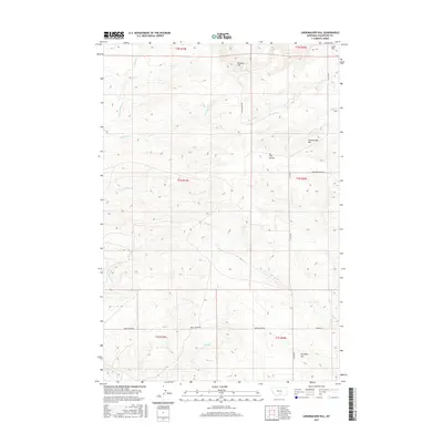
2017 Map of Lindemulder Hill
USGS Topo · Published 2017About this map
Lindemulder Hill and its surrounding heights define this high-country landscape in Stillwater County. This topographical study illustrates a region of complex drainage networks, where Kenyon Cr and McNally Cr carve through the terrain north of a prominent ridge known as The Divide. The rural character of the area is emphasized by its sparse road network, including the historically named Stagecoach Rd and Berry Creek Rd, which follow natural contours between the prominent rises of Busteed Hill and Pershing Hill. Further south, Keyser Cr and Berry Cr mark the lower elevations. The map reveals the intricate intersection of private property lines and public land survey boundaries across several townships, providing a clear view of the territorial divisions near Love Hill and Struck Cr during the early 21st century.
Find a feature on this map
25 named features on this map. Tap any name to fly to it.
Don’t see what you’re looking for? This feature index may not catch every label — zoom into the map to look around manually.
Map Details
Editions of this 2017 Lindemulder Hill Map
This is the sole edition of this map. No revisions or reprints were ever made.
Other maps of this area

1892 · Stillwater
USGS Topo · 1:125,000

1954 · Billings
USGS Topo · 1:250,000

1955 · Antelope Point
USGS Topo · 1:24,000

1955 · Springtime
USGS Topo · 1:24,000

1955 · Russell Gulch
USGS Topo · 1:24,000

1956 · Columbus West
USGS Topo · 1:24,000

1956 · Rapelje
USGS Topo · 1:24,000

1956 · Battle Butte
USGS Topo · 1:24,000

1956 · Columbus East
USGS Topo · 1:24,000

1956 · Lindemulder Hill
USGS Topo · 1:24,000