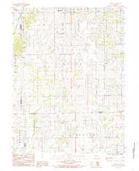
1984 Map of Lindley
USGS Topo · Published 1985About this map
Humphreys and Lindley anchor this landscape at the intersection of Sullivan, Grundy, and Linn counties during the early 1980s. The area is defined by a dense network of waterways that dictate the rural settlement patterns, most notably Medicine Creek in the northwest and the winding courses of Muddy Creek and Little Muddy Creek. This survey reveals a region of small townships including Taylor and Jackson, where scattered farmsteads are linked by a grid of improved and unimproved roads. Further south, the map documents the smaller communities of Haseville and Parsons, situated near Parson Creek. The presence of numerous named branches like Brushy Branch and Smokey Creek highlights the intricate drainage systems that carved the local topography prior to modern land-use changes.
Find a feature on this map
20 named features on this map. Tap any name to fly to it.
Don’t see what you’re looking for? This feature index may not catch every label — zoom into the map to look around manually.
Map Details
Editions of this 1984 Lindley Map
This is the sole edition of this map. No revisions or reprints were ever made.
Other maps of this area

1924 · Chula
USGS Topo · 1:62,500

1946 · Brookfield
USGS Topo · 1:62,500

1946 · Galt
USGS Topo · 1:62,500

1947 · Chula
USGS Topo · 1:62,500

1948 · Brookfield
USGS Topo · 1:62,500

1949 · Galt
USGS Topo · 1:62,500

1953 · Moberly
USGS Topo · 1:250,000

1954 · Centerville
USGS Topo · 1:250,000

1954 · Moberly
USGS Topo · 1:250,000

1957 · Moberly
USGS Topo · 1:250,000