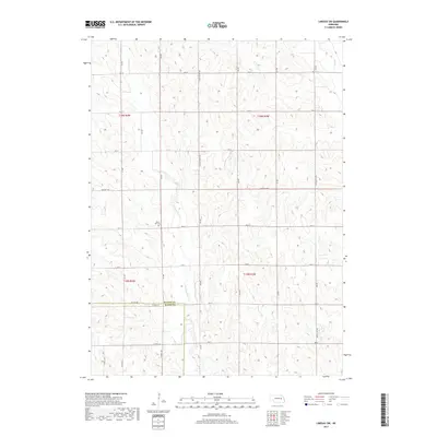
2017 Map of Lindsay SW
USGS Topo · Published 2017About this map
Looking Glass Cr winds through this rural Nebraska landscape, defining the drainage patterns of Platte and Nance counties. The 2017 survey reveals a highly organized agricultural grid, where long-established section lines are served by thoroughfares like Central Hwy and Lindsay Genoa Rd. This map is particularly valuable for genealogists and local historians tracking family plots at the West Hill Cem, situated near the intersection of 325 St and 460 Ave. The terrain is characterized by the subtle divides between Shell Cr in the northeast and Lost Cr to the southeast. The boundary between Platte Co and Nance Co is clearly demarcated along Co Line Rd, reflecting the formal political divisions of the Nebraska prairie that have persisted since early settlement.
Find a feature on this map
33 named features on this map. Tap any name to fly to it.
Don’t see what you’re looking for? This feature index may not catch every label — zoom into the map to look around manually.
Map Details
Editions of this 2017 Lindsay SW Map
This is the sole edition of this map. No revisions or reprints were ever made.
Other maps of this area

1896 · Stromsburg
USGS Topo · 1:125,000

1955 · Fremont
USGS Topo · 1:250,000

1957 · Fremont
USGS Topo · 1:250,000

1958 · Fremont
USGS Topo · 1:250,000

1958 · Genoa
USGS Topo · 1:24,000

1958 · Monroe
USGS Topo · 1:24,000

1958 · Fullerton NE
USGS Topo · 1:24,000

1958 · St. Edward
USGS Topo · 1:24,000
1966 · Newman Grove
USGS Topo · 1:24,000

1966 · Tarnov
USGS Topo · 1:24,000