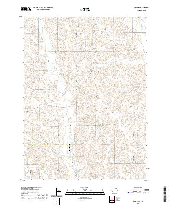
2021 Map of Lindsay SW
USGS Topo · Published 2021About this map
Looking Glass Cr winds through this agricultural section of the Nebraska plains, defining a landscape marked by its traditional section-line road network. The terrain is notably divided by the boundary between Platte and Nance Counties in the southern portion of the quadrangle. This 2021 update from the U.S. Geological Survey documents the enduring rural character of the region, where family heritage is anchored at the West Hill Cem situated near the intersection of 460 Ave and 325 St. Other vital waterways including Shell Cr and Lost Cr traverse the township boundaries, supporting the local drainage system. The map details a web of local transit corridors such as Central Hwy, Mcphillips Hwy, and the Lindsay Genoa Rd, which continue to serve as the primary infrastructure for the area's farming community.
Find a feature on this map
30 named features on this map. Tap any name to fly to it.
Don’t see what you’re looking for? This feature index may not catch every label — zoom into the map to look around manually.
Map Details
Editions of this 2021 Lindsay SW Map
This is the sole edition of this map. No revisions or reprints were ever made.
Other maps of this area

1896 · Stromsburg
USGS Topo · 1:125,000

1955 · Fremont
USGS Topo · 1:250,000

1957 · Fremont
USGS Topo · 1:250,000

1958 · Fremont
USGS Topo · 1:250,000

1958 · Genoa
USGS Topo · 1:24,000

1958 · Monroe
USGS Topo · 1:24,000

1958 · Fullerton NE
USGS Topo · 1:24,000

1958 · St. Edward
USGS Topo · 1:24,000
1966 · Newman Grove
USGS Topo · 1:24,000

1966 · Tarnov
USGS Topo · 1:24,000