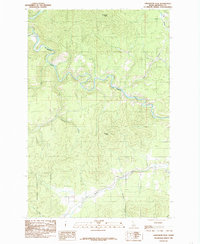
1985 Map of Lindstrom Peak
USGS Topo · Published 1985About this map
The St Maries River carves a serpentine path through northern Idaho's timberlands in this mid-1980s provisional survey. Anchored by the prominence of Lindstrom Peak and Peterson Point, the landscape reflects the dense topography of the St Joe National Forest. This section of Benewah County is defined by its complex drainage network, where numerous tributaries like Santa Creek, Alder Creek, and Carlin Cr feed into the primary river valley. The map documents the intricate road and trail systems used for forest management and access to high-elevation lookouts, providing a clear view of the wilderness character of the region before modern development. Notable geographic features such as the Flat highlight the localized level ground found amidst the steep ridges of the Clearwater Mountains range.
Find a feature on this map
13 named features on this map. Tap any name to fly to it.
Don’t see what you’re looking for? This feature index may not catch every label — zoom into the map to look around manually.
Map Details
Editions of this 1985 Lindstrom Peak Map
This is the sole edition of this map. No revisions or reprints were ever made.
Other maps of this area

1955 · Spokane
USGS Topo · 1:250,000

1957 · St. Maries
USGS Topo · 1:62,500

1957 · Emida
USGS Topo · 1:62,500

1957 · St. Joe
USGS Topo · 1:62,500

1958 · Spokane
USGS Topo · 1:250,000

1961 · Fernwood
USGS Topo · 1:62,500

1981 · St Maries
USGS Topo · 1:100,000
1981 · St Maries
USGS Topo · 1:24,000
1981 · Benewah Lake
USGS Topo · 1:24,000
1985 · St. Joe Baldy
USGS Topo · 1:24,000