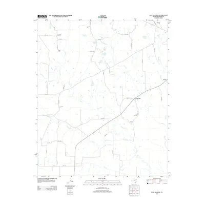
2012 Map of Line Branch
USGS Topo · Published 2012About this map
Cuthand Cr and Gouchy Cr define the hydrological character of this Red River County landscape, flowing through a rural region marked by a network of small settlements and family cemeteries. The community of Liberty sits in the northwest, supported by its local Liberty Cem, while the hamlet of Lone Star serves as a central waypoint along the local road system. The presence of multiple burial sites, such as the Catonville Cem and Thompson Cem, suggests a long-established rural population and provides specific points of interest for genealogical research in Northeast Texas.
Find a feature on this map
52 named features on this map. Tap any name to fly to it.
Don’t see what you’re looking for? This feature index may not catch every label — zoom into the map to look around manually.
Map Details
Editions of this 2012 Line Branch Map
This is the sole edition of this map. No revisions or reprints were ever made.
Other maps of this area

1953 · Texarkana
USGS Topo · 1:250,000

1956 · Texarkana
USGS Topo · 1:250,000

1963 · Cunningham
USGS Topo · 1:24,000

1964 · Detroit
USGS Topo · 1:24,000

1964 · Deport
USGS Topo · 1:24,000

1964 · Bagwell
USGS Topo · 1:24,000

1964 · Cuthand
USGS Topo · 1:24,000

1964 · Bogata
USGS Topo · 1:24,000
1964 · Dimple
USGS Topo · 1:24,000
1964 · Line Branch
USGS Topo · 1:24,000